ALDiS – Automated digitisation of large-scale landscapes
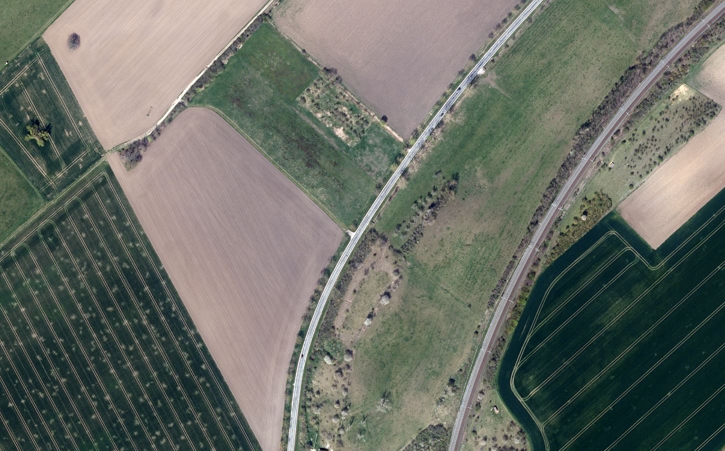
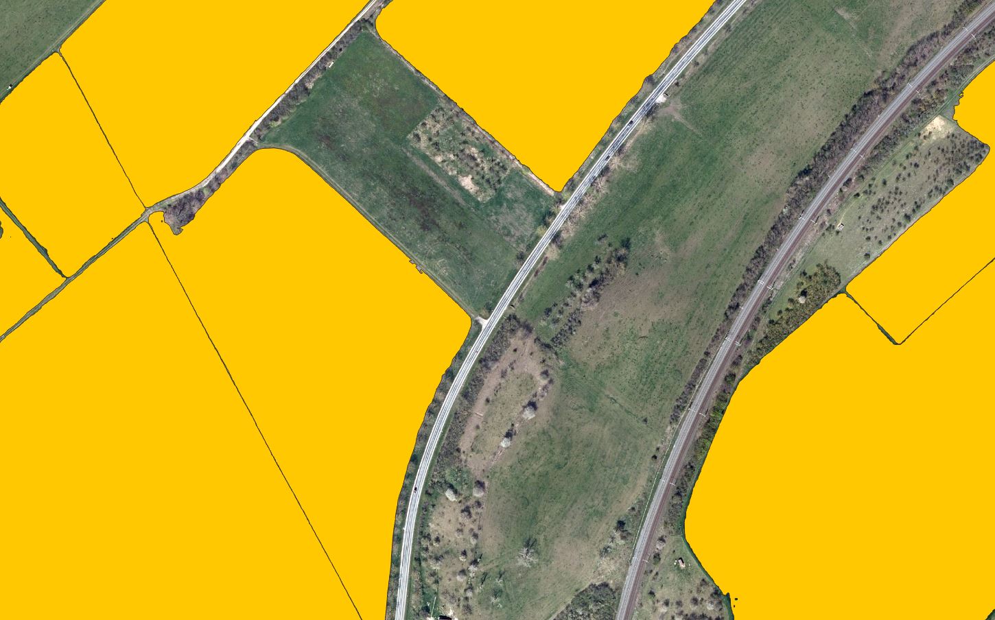
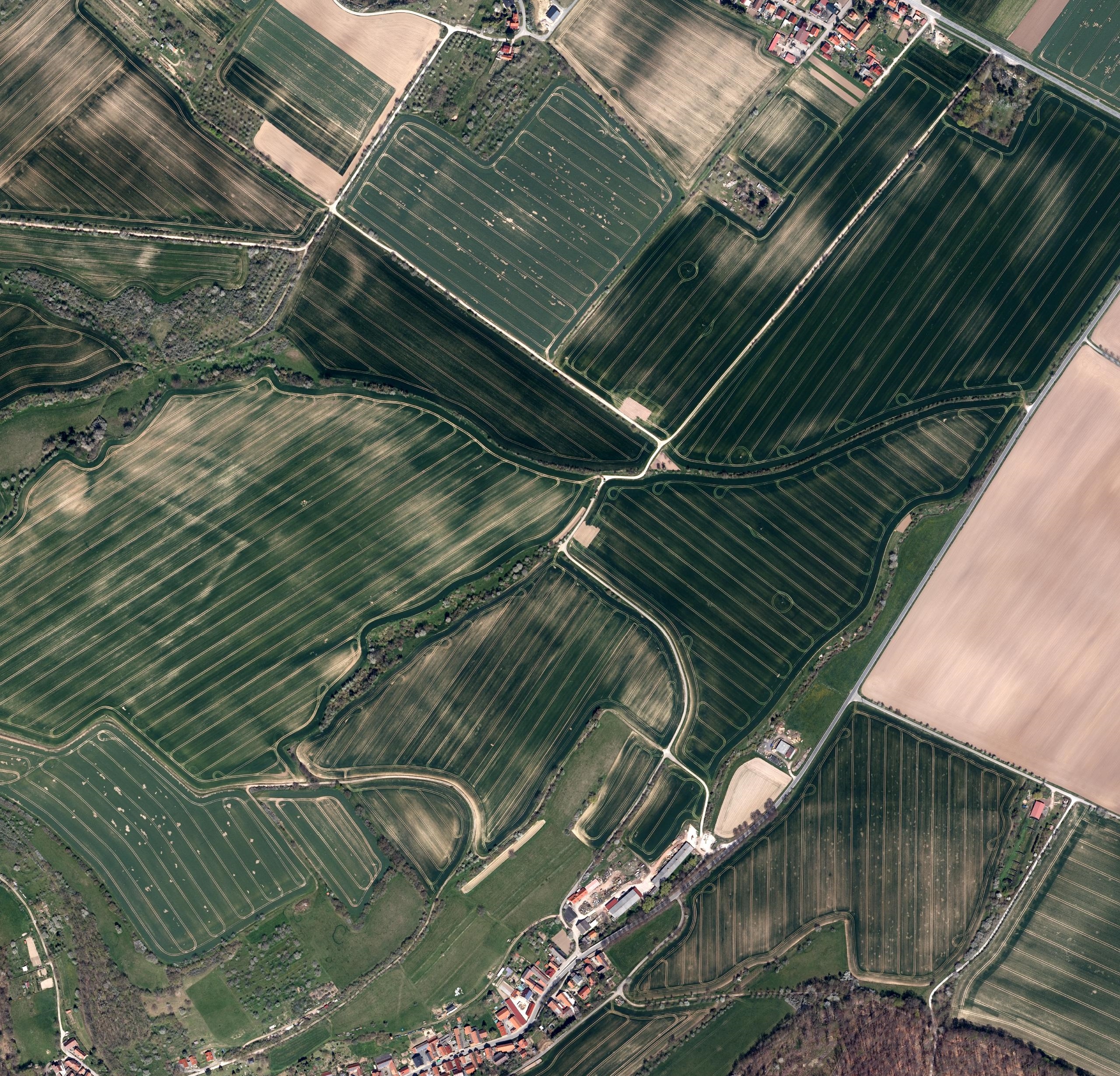
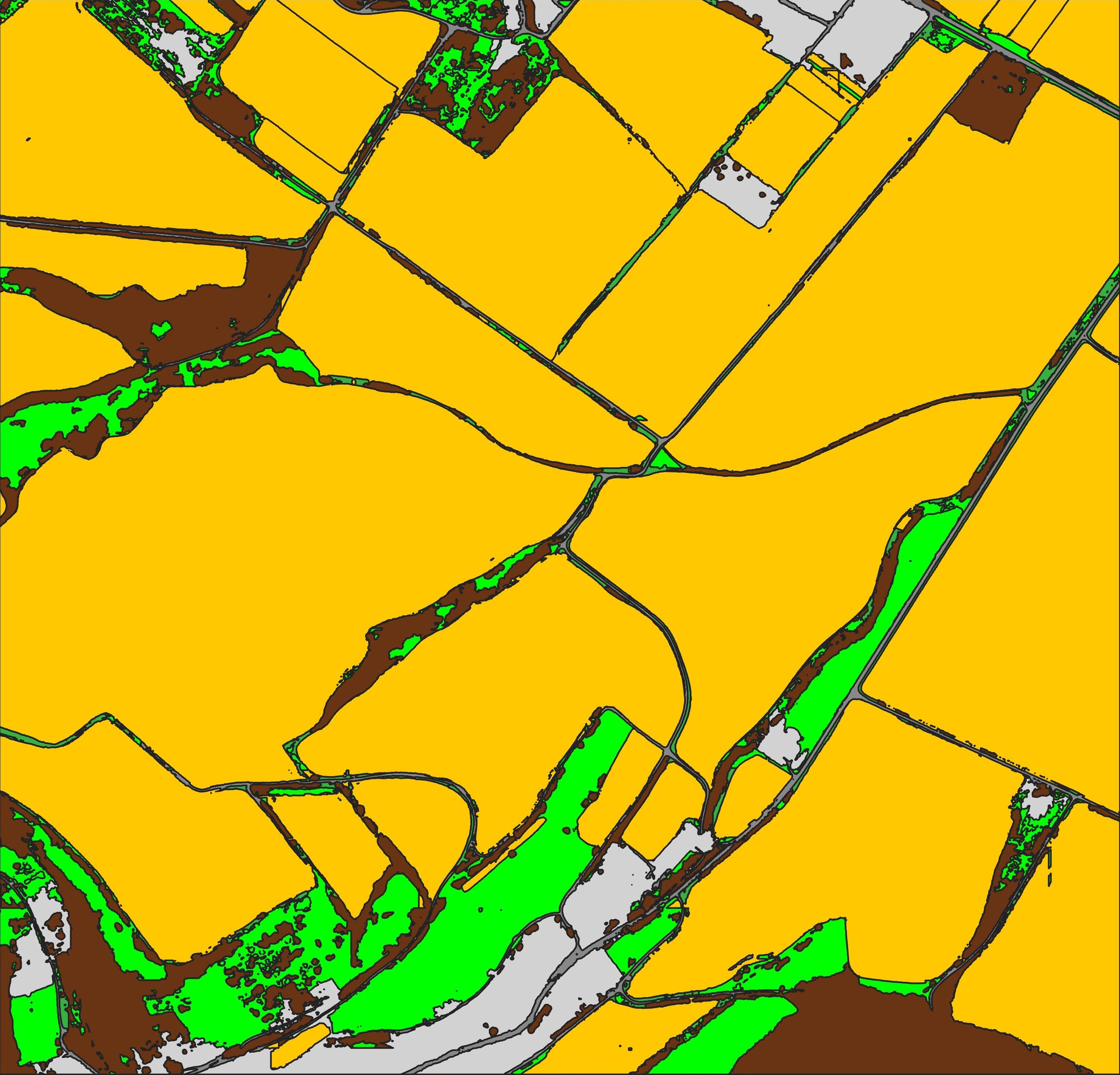
Are you tired of manual digitisation of large landscapes? Why not use automated digitisation systems? We developed a new automated digitisation system based on the latest artificial intelligence computer methods: ALDiS (Automated Landscape Digitisation System). While other systems apply segmentation methods to identify fields, settlements or forest or other features, our approach follows the way we humans see landscapes. We see the e.g. the field and not a bunch of more or less similar pixles. Time consuming post-processing of geometries has previously often has been necessary. With our new, artificial intelligence based approach, much less manual correction is needed, if any. Clear boundaries are detected and even small features such as roads are recognised. Automatically extracted field boundaries are as accurate as human interpretation. Our autmated digitisation system can be applied to various areas of GIS modelling, such as agricultural field mapping, environmental monitoring, public infrastructure and much more.
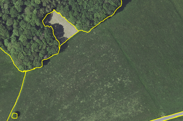 |  | 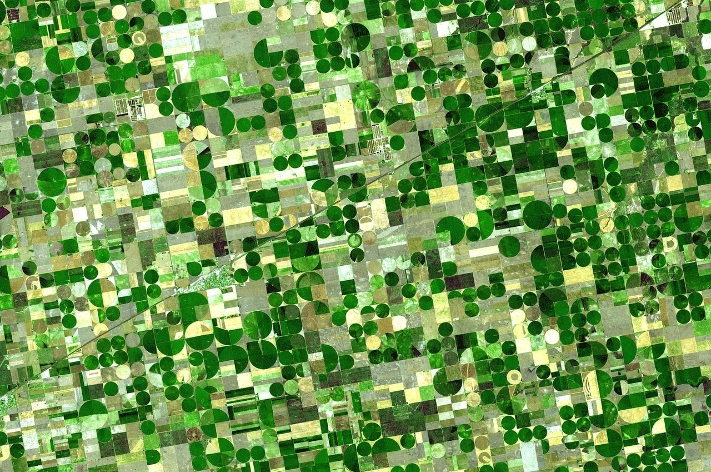 | 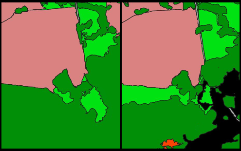 |
| Highly-accurate boundaries Clear boundaries are detected even for small features such as roads. | Applicability ALDiS is applicable to various imagery with different resolution (Satellite, aircraft, drones). | Object-based solutions ALDiS can be applied to small-sized, specific objects along with the landscapes. | Change detection Trained model with ALDiS can effectively automate time-series data analysis. |
See this poster with an application of ALDiS, presentd at the SETAC Europe conference (2023) or the following examples produced by the automatic recognition system: